Image by Libertinus via Flickr
For the past several years, my research has led me further and further into the world of counterinsurgency, military anthropology, human terrain, and other aspects of a military regime of knowledge. What concerns me, most of all, is the way that knowledge generated by social scientists can be used (and, if the past is any indication, will be used) to the disadvantage of the people on, from, and with whom anthropologists and other social scientists generate that knowledge.
This issue is hardly limited to anthropologists, though we have traditionally held a kind of loose monopoly on the world’s most vulnerable peoples. Nowadays, social scientists of every stripe traipse through the same terrain anthropologists once considered their own – and we, of course, have no problem returning the favor.
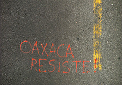
So when a friend forwarded me a story about geographers in Oaxaca mapping the “cultural terrain”, my disciplinary ears perked up. At issue are many of the same issues at play in debates over anthropologists’ and others’ involvement with HTS in Iraq and Afghanistan, although in many ways I find the situation I’m about to describe more frightening still, as it presages wars or conflicts as yet unfought – even counterinsurgencies to insurgencies yet to surge.
México Indigena and Mexican Indigenes
From 2005-2007, a team of geographers led by Jerome Dobson and Peter Herlihy of the University of Kansas worked with local trainees to map land ownership and claims on collective lands in indigenous communities in Oaxaca and San Luis Potosi. Called “México Indigena” and partially funded by the US Army’s Foreign Military Studies Office (FMSO), the project was a pilot program for the American Geographic Society’s Bowman Expeditions, which intends to create maps of the “cultural terrain” of poor and indigenous communities throughout the world.
Dobson’s project seems on its surface like a straightforward exercise in cultural geography. Working with a local university, México Indigena trained members of local communities to collect GIS data throughout their communities, with particular emphasis on defining privately- and communally-held lands. This data is useful for communities wishing to document their holdings, as well as to researchers interested in studying the impact of Mexico’s PROCEDE program, which shifts public and communal lands into private hands. México Indigena is committed to producing “open source” data that can be used freely by the communities they study (a concept worth revisiting, as “open source” neatly cuts across both the Open Source software movement on one hand and the Open Source intelligence movement on the other).
What makes México Indigena troubling is the involvement of FMSO. Headquartered at the Leavenworth Army Base, FMSO is explicitly concerned with counterinsurgency and “asymmetric” warfare. According to its website, its mission is to provide analysis and data on “emerging and asymmetric threats, regional military and security developments, and other issues that define evolving operational environments around the world”. There is some question about FMSO’s relationship with the Army’s Human Terrain Studies (HTS) program—the relationship is close enough that several sources have claimed HTS is part of FMSO (e.g. Mychalejko 2009), where the program apparently originated before being transferred to another office of the Army.
Whatever the relationship, FMSO is directly involved in the development of human terrain as a military paradigm. Which is why Dobson approached FMSO’s IberoAmerican researcher, Lt. Col. Geoffrey B. Demarest, requesting a half-million dollars in funding for México Indigena —part of a hoped-for $125 million for Bowman Expeditions’ proposed worldwide human terrain mapping. In his proposal, Dobson justified his project by explicitly citing their usefulness for state ends, particularly military action:
The greatest shortfall in foreign intelligence facing the nation is precisely the kind of understanding that geographers gain through field experience, and there’s no reason that it has to be classified information… The best and cheapest way the government could get most of this intelligence would be to fund AGS to run a foreign fieldwork grant program covering every nation on earth (Dobson, in Mychalejko and Ryan 2009).
For Lt. Col. Demarest, this kind of research is highly desirable. Demarest is the author of several papers and a book, Geoproperty: Foreign Affairs, National Security, and Property Rights (1998), on the importance of private property as part of a democratic system and privatization as a tool for incorporating communities into the global market and for defending national security, with a special focus on Latin America. The gist of Demarest’s work is that:
[I]nformal property ownership in either rural or urban settings is the breeding ground for criminal or insurrectionary activity…. He specifically cites concerns about the criminality of large areas of the dispossessed, as they become separately governed autonomous zones….
Demarest asserts that the privatization of property is the key to stability, prosperity, progress, and security in Latin America, and that formal land titling leads to effective government control [and] existing property of real value must be made secure… through a phenomenon he describes as the “architecture of control” (Sedillo 2009).
As if that weren’t troubling enough—and somewhat at odds with the stated goals of Dobson and Herlihy, to explore the implications of privatization in indigenous communities—there is the question of FMSO’s official interest in the Oaxaca region of Mexico. What is the operational function of this kind of data, and why would the US Army pay so richly for it?
Pre-emptive counterinsurgency
FMSO’s interest in Oaxaca makes more sense in the context of the Merida Initiative, or as critics call it, “Plan Mexico”, after its similarities with the US government’s disastrous Plan Colombia. Merida is a program of long-term military support for Mexico to help stem the production and transfer of illegal drugs in and through Mexico.
Overlapping as it did with the 2006 uprising and seizure of the city of Oaxaca by the Oaxacan People’s Popular Assembly (APPO) and its seven-month occupation as the Oaxaca Commune, the collection of human terrain data on behalf of the US Army has particularly sinister overtones. Demarest’s two interests—democratization through privatization and suppression of insurgency through culturally-informed military action—seem to come together all too nicely in Oaxaca, which is why I’ve started to think of this as a program of pre-emptive counterinsurgency, combining two of the darkest aspects of the Bush-era military: pre-emptive warfare and human terrain-based counterinsurgency.
México Indigena raises hard questions about the relationship between the military and the social sciences, and about the uses of cultural knowledge. Communities in Oaxaca have complained that the project’s members never made clear that their research was funded by the US military, which has raised concerns over what local activists have termed “geopiracy”—given Demarest’s thoughts on communal property, the idea that the collection of GIS data in this region, collated with communal property holdings, could be used to sustain a large-scale appropriation of land by the Mexican state and apportionment to private interests—likely corporate interests—does not seem so far-fetched.
Neither does the fear that this data would be used as part of counterinsurgency efforts to undermine local radical leadership and prevent the kind of wide-scale organizing Mexico has fought in neighboring Chiapas. Under the guise of the War on Drugs, local political opponents of the Mexican state could well find themselves branded “insurgents” and targeted by a military force—one the Mexican government has not been at all averse to using in place of regular police—informed by up-to-date GIS data. The rising drug production and trafficking in Oaxaca, as well as the recent drug-related violence across the US-Mexico border, make this all the more troubling – especially when coupled with the notion that communal and informal land tenure fosters “criminal and insurrectionary” behavior.
Dobson’s argument that the data collected is available to everyone, including the local communities, rings somewhat hollow, especially the use of the phrase “open source” to describe the project. As an advocate of scientific transparency and open access to cultural data, I find myself highly conflicted by the use of the phrase “open source” to describe research funded by the FMSO, which houses the Army’s Open Source Intelligence (OSINT) training program. According to FMSO’s training document (http://fmso.leavenworth.army.mil/OSINT-Training.pdf),
In addition to offering alternative sources to validate or challenge classified sources, OSINT can provide essential foundation knowledge for operational and decision-making requirements. This can include historical background, political developments, socioeconomic and demographic context, cultural insight, geographic, and technical and critical infrastructure data. OSINT can be used to monitor foreign events and perspectives. OSINT is also particularly useful for independent application in the training environment, to include “red cell” studies and threat analysis. OSINT proffers the widest dissemination capability of any intelligence discipline while generating the least political risk, benefiting inter-agency and international cooperative efforts.
Taking sides
Of course, many will say that if this information is available, there’s nothing that will stop the military from using it, and I agree with that. What concerns me here is not the military using this information so much as the military commissioning and funding the collection of this information—and future plans to collect much, much more. Already Bowman Expeditions have begun a similar mapping program in the Antilles, with a third project planned (and possibly already underway) in Colombia (Dobson 2009). We have to ask not only what this data will be used for—a consideration that does not seem to have been impressed nearly adequately enough on the people of Oaxaca—but how those goals shape the data, both in what is recorded and what is not.
More importantly, we have to ask about the moral and practical effects of social scientists actively working to provide information intended to better equip the US military for warfare in the regions they study. While I have been somewhat skeptical of arguments about “blowback” endangering anthropologists in the field, programs like México Indigena make it quite hard to dismiss the likelihood that future American researchers will be taken for agents of the US military. More importantly, in equipping governments not only for war against our research subjects but to conduct assimilative projects aimed to “democratize” indigenous peoples by targeting communal landownership and other collective behaviors, we violate a primary ethical tenet, to do what is in our power to assure that our research does not harm the people we have studied.
As an internal disciplinary matter, there is already an uproar among geographers and an investigation into the matter of compliance with a code of ethics that’s not to different from anthropologists’. Like us, geographers worry about informed consent – and reports of information about US Army funding being withheld from Oaxacan communities suggest that the “informed” part my have been paid less than it’s due in this case. But whatever move(s) geographers take or don’t take, this use of social science, whatever its disciplinary origins, raises a lot of uncomfortable questions for all of us.
Among them – first among them, I would think – is how complicit social scientists want to be if and when this kind of data is applied in a military setting, whether by our own military in the context of a counterinsurgency or the great American umbrella of the War on Drugs (apparently due for rebranding by the Obama administration), or by other governments in partnership with ours? This is not a question of personal moral choice – how can it be? It’s also not a question of “defrocking” social scientists “gone bad” – this is a question of overall disciplinary direction and, ultimately, of our commitment not just to our own research but to the people who make it possible. Where – and how – do we draw the line where that commitment becomes irrelevant?
Work Cited
Dobson, Jerome. 2009. AGS Bowman Expeditions. American Geographical Society Website. URL: http://www.amergeog.org/bowman-expeditions.htm (last accessed 4/19/09).
Mychalejko,Cyril and Ramor Ryan. 2009. U.S. Military Funded Mapping Project in Oaxaca: Geographers used to gather intelligence? Z Magazine 22(4). URL: http://www.zmag.org/zmag/viewArticle/21044 (last accessed 4/19/09).
Sedillo, Simon. 2009. The Demarest Factor: The Ethics of U.S. Department of Defense Funding got Academic Research in Mexico. El Enemigo Común (website). URL: http://elenemigocomun.net/2255 (last accessed 4/19/09).
There’s a recent Annual Review article which is relevant: http://dx.doi.org/10.1146/annurev.anthro.34.081804.120429
It should go without saying that geographic documentation can also help prevent the exploitation of vulnerable peoples. Whether the people of Oaxaca—and what does that mean in this context? are we talking about federal/state/local/“traditional” governments? title holders? individuals in general?—were already aware of this fact or had yet to have had it adequately impressed upon them when consenting to the project also seems germane.
I liked this article very much. I had planned to write on the same topic, delayed, and then you “scooped” me you #@&%$ ! Well, it was not going to be any scoop anyway, and I don’t think it would have been as good as this. I am surprised that this post has not received more commentary to this point. I guess that’s good news then: no disagreement from anyone.
I wanted to say thanks for the effort that went into this piece. I have forwarded it to various folks with special interests in the issue.
Like Maximillian Forte I have wondered about the general quietness around here. My guess is that it is a mix of summer busyness (kids, articles, trips, fieldwork) combined with many people poking around and experimenting in OAC. Wouldn’t Oneman’s very useful post be the kind of thing that the discussion groups in OAC would want to be discussing? Maybe that can be orchestrated.
Overall I liked this piece, however it failed in providing more details as to WHY the U.S. military would be interested in that particular region. Are there valuable mineral or oil resources there? Is it purely an issue of drug trafficking? Such are issues that need to be explored more clearly. Also it did not explain how the indigenous people saw the program moving communal and public (meaning state owned) lands to private hands. If the people want to do it, who are we to say, “No you can’t!”? If they don’t and were forced into this program by the government, then there are many questions to ask such as whether the tribes have proper legal representation, whether their tribal leaders have been coerced, and whether they had any anthropologists advocating for them.
So this article, gives me more questions then answers as things are not always what they appear.
I had a rather profound and fortunate experience when as a graduate student, I had the good fortune of taking a class with a remarkable professor of Economic Anthropology by the name of Scott Cook. He is a Marxist anthropologist and at the time I was a fairly die-hard Marxist in my ideas about economics. His class completely illuminated my eyes to how Marxism and Capitalism works in the real world and especially in Mexico. One of the things that I never even thought about was that he pointed out that in areas of communal land sharing, not all farmers were of the same mind living in one big happy family. Many firmly believed that they could do better with their own land and be free to pursue types of crops that they believed would improve their family’s standard of living. He did not say they were wrong and he did not say they were right. Only that this was a fact and that applied Marxism runs into the brutal reality of economic choice and naturally occurring divisions within populations that can be influenced by economic and political conditions. In short… that it was not always the Gringo to blame but rather basic market economics, real life hardships, and disagreements over economic decision making that could cause a particular farmer to want to fracture off from the communal lands. Now this professor was still Marxist, but he was also a realist who was guided by anthropological data rather then blind economic/political ideology.
Since then, while my socialist bias urges me to rush to judgment, my other half remembers Dr. Cook’s words and reminds me that the whole story is often not told in such articles and as such leaves me with many questions.
With that said, the United States military has always made contingency plans for warfare in every part of the world. That is no secret and nothing new. One of the chief jobs of CIA officers in embassies for example is simply to gather open-source data on the host nation in order to maintain up to date files on the basic information of that country. This may be just part of a more fine-tuned method of updating such files. However for counter-insurgency such data would be useless unless kept up to date yearly as politics and events can cause rapid and violent changes that can not always be predicted. That would be a monumental task if done on a world-wide basis.
A more likely “evil” scenario would be a plan on buying out private land below market value from indigenous people in order to secure rights for mineral, natural gas, or oil resources that American or transnational energy corporations could exploit. However since this project is public, if it has no mention of such possibilities, then the social scientists involved will be crucified in academic circles.
In summary, if we are really concerned about this, we should read the public report on this particular human terrain study as well as see if any other social scientists have published any work regarding this region that perhaps might paint a different picture.
If it does, or you start seeing these indigenous people getting screwed out of their land under this program by the Mexican government, THEN sound the alarm bells with full force and I will be just as outspoken against such usages of human terrain data.